 Sale!
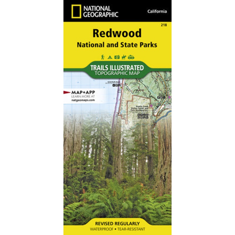
Sale! Redwood National and State Parks Map
$11.96
$14.95
Quick Overview
Waterproof Tear-Resistant Topographic MapLet National Geographic's Trails Illustrated map of Redwood National and State Parks guide you on your adventure among the tallest trees in the world. Expertly researched and created in partnership with the National
- Satisfaction 100% Guaranteed
- Free shipping on orders over $30
- 60 day easy Return
Waterproof Tear-Resistant Topographic Map
Let National Geographic’s Trails Illustrated map of Redwood National and State Parks guide you on your adventure among the tallest trees in the world. Expertly researched and created in partnership with the National Park Service, California States Parks, U.S. Forest Service and others, the map has bountiful information and safety tips that are essential when exploring the area. Some of the key points of interest included are Six Rivers National Forest, Smith River National Recreation Area, North Fork Smith River Botanical Area, Siskiyou Wilderness, Humboldt Lagoons State Park and Yurok Indian Reservation.
The map will guide you to trailheads and then along clearly marked trails with mileage indicators between intersections, colored according to their designated usage. There is a table of featured hikes, including trail name, distance, difficulty and trail description. Additionally, the map base includes contour lines and elevations for peaks and summits. For those preferring an aquatic adventure, mileage markers are also included along the Klamath Wild and Scenic River. The Redwood Highway Scenic Byway is marked for those wishing to explore the area by car. Many recreation activities are available in the area and marked on the map, including motorized and non-motorized boat launches; river and beach access points; swimming and windsurfing areas; campgrounds, primitive campsites and cabins; and lookout towers and wildlife viewing areas.
Every Trails Illustrated map is printed on “Backcountry Tough” waterproof, tear-resistant paper. A full UTM grid is printed on the map to aid with GPS navigation.
Other features found on this map include: Big Lagoon, Klamath National Forest, Klamath River, Lake Earl, Maple Creek, Pelican Bay, Point Saint George, Redwood, Rocky Point, Saint George Reef, Siskiyou Mountains, Siskiyou National Forest, Siskiyou Wilderness, Six Rivers National Forest, Smith River, Trinidad Head.
| Cost: | $25 |
| Free Shipping | We offer free shipping on orders over $30. Please check the free - shipping eligibility at checkout. |
| Delivery Time: | It usually takes [3-5] business days for standard shipping. Please note that this is an estimated time frame and may be affected by local holidays, and unforeseen circumstances. |
Reviews
There are no reviews yet.