 Sale!
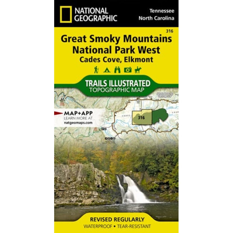
Sale! Great Smoky Mountains National Park West
$9.56
$11.95
Quick Overview
Waterproof Tear-Resistant Topographic MapAmerica's most visited national park and a UNESCO World Heritage Site, Great Smoky Mountains National Park is both renowned for its diversity of plant and animal life and rich in remnants of Southern Appalachian mou
- Satisfaction 100% Guaranteed
- Free shipping on orders over $30
- 60 day easy Return
Waterproof Tear-Resistant Topographic Map
America’s most visited national park and a UNESCO World Heritage Site, Great Smoky Mountains National Park is both renowned for its diversity of plant and animal life and rich in remnants of Southern Appalachian mountain culture. National Geographic’s Trails Illustrated map of Cades Coves and Elkmont, covers the western part of the park, from Sugarlands Visitor Center area in the east to the western boundary of the park with Chilhowee Mountain and Lake. Created in partnership with the National Park Service and others for all kinds of outdoor enthusiasts seeking to explore the area, the map combines unparalleled detail of the region, essential area information and safety tips, including bear safety and valuable contact information. The map features many key points of interest as well, including Fontana Lake and Dam, Little Tennessee and Tuckasegee Rivers Cable Mill Historic Area and Abrams Creek.
The park map has clearly marked trails with mileages between intersections. The map base includes contour lines and elevations for summits, passes and many lakes. Listed are stream crossings, as well as backcountry campsites and shelters along with their location, elevation and capacity. The Appalachian National Scenic Trail, Mountains-to-Sea Trail and Benton Mackaye Trail are all highlighted, providing a handy tool for hikers. Some of the many recreation features include: visitor centers, campgrounds, trail shelters, trailheads, boat ramps, scenic overlooks, waterfalls, lookout towers, ski areas, interpretive trails and quiet walkways. The Indian Lakes Scenic Byway is marked for those wishing to explore the area by car.
Every Trails Illustrated map is printed on “Backcountry Tough” waterproof, tear-resistant paper. A full UTM grid is printed on the map to aid with GPS navigation.
Other features found on this map include: Cherokee National Forest, Clingmans Dome, Fontana Lake, Great Smoky Mountains, Nantahala National Forest.
| Cost: | $25 |
| Free Shipping | We offer free shipping on orders over $30. Please check the free - shipping eligibility at checkout. |
| Delivery Time: | It usually takes [3-5] business days for standard shipping. Please note that this is an estimated time frame and may be affected by local holidays, and unforeseen circumstances. |

![Rocky Mountain National Park Day Hikes [Booklet]](https://www.ultratrekpack.com/wp-content/uploads/2025/5/1748493426/rocky-mountain-national-park-day-hikes-booklet-1748493431.webp)
Reviews
There are no reviews yet.